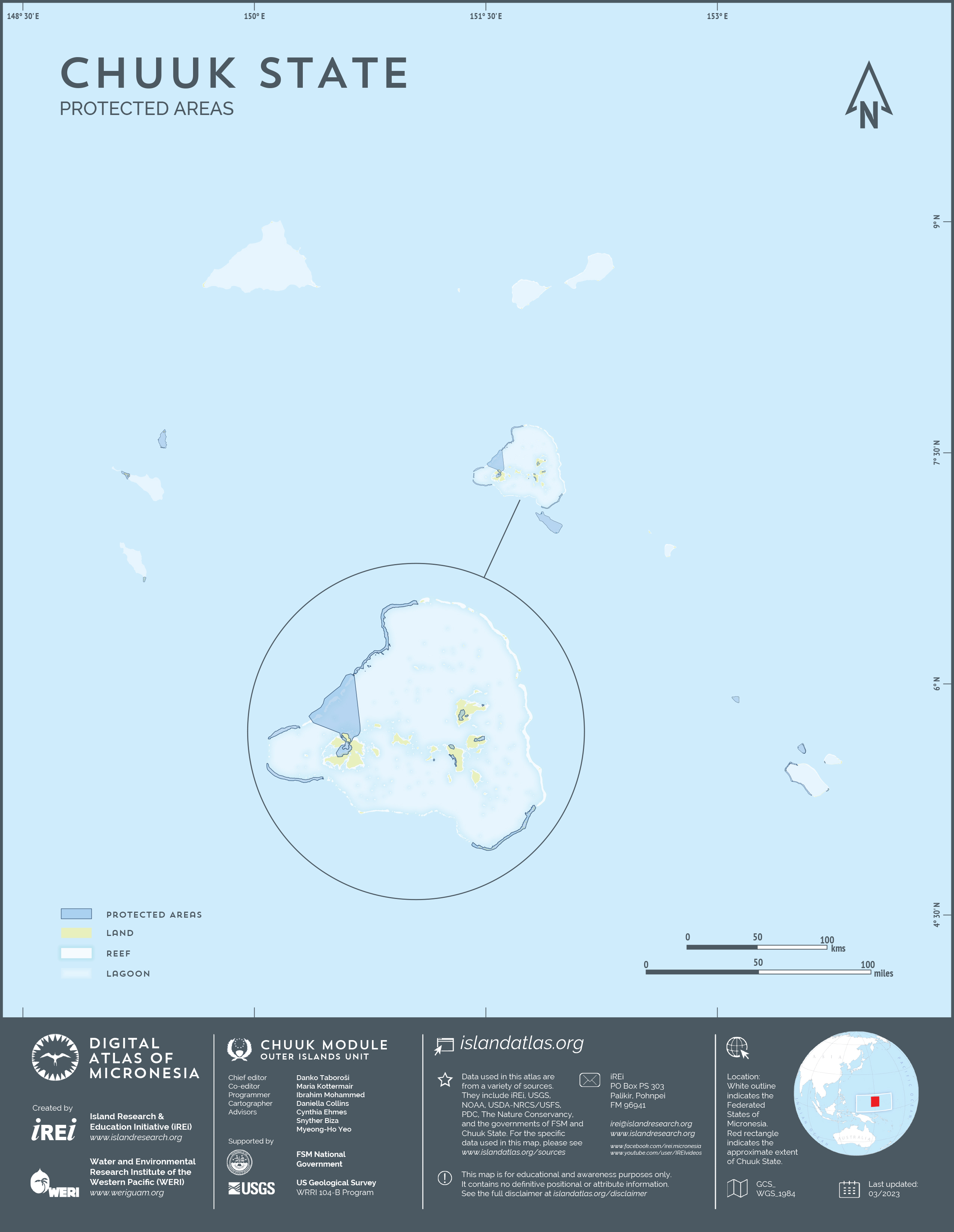
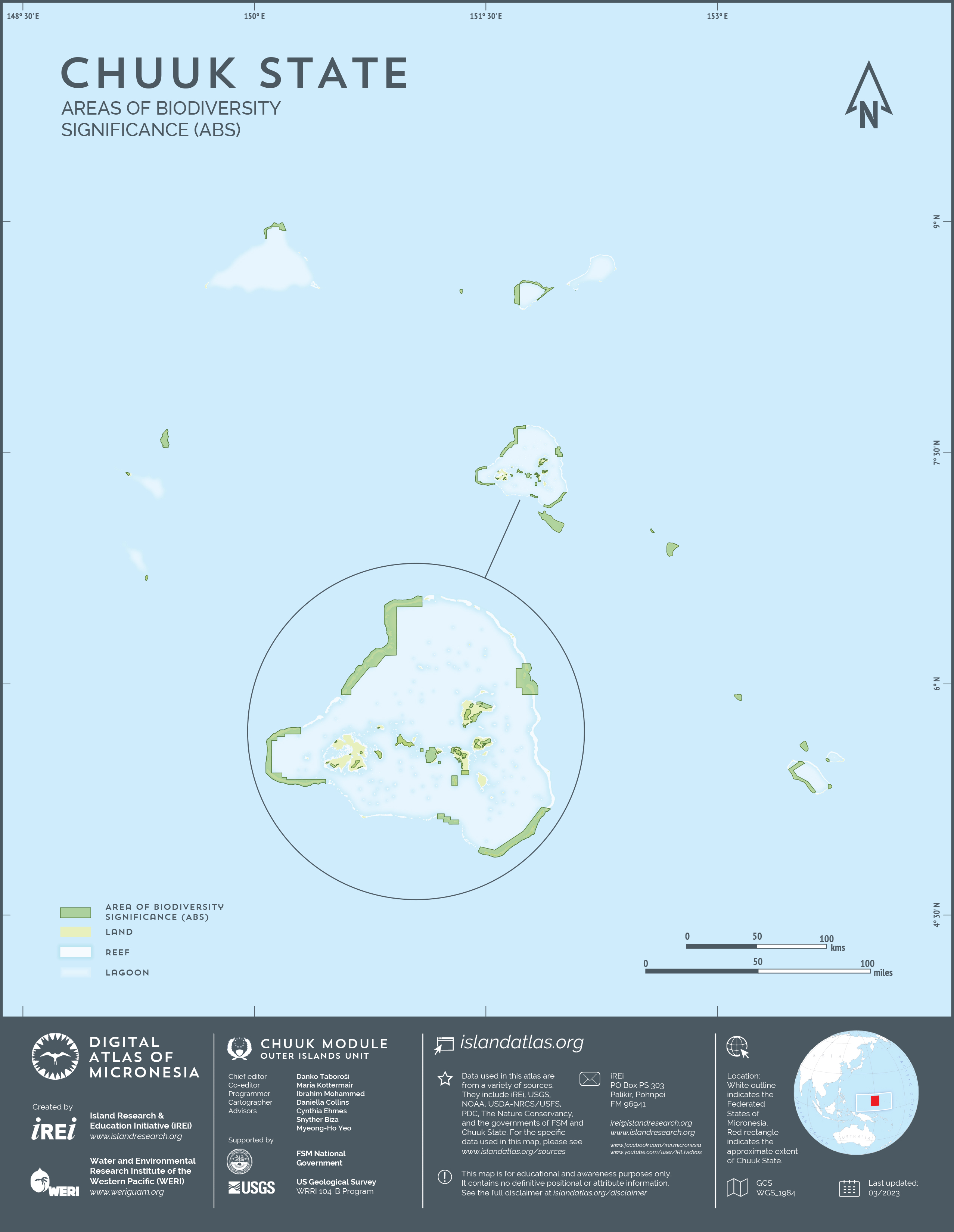
Areas of biodiversity significance
This map shows the Areas of Biological Significance (ABS) in and around the Outer Islands of Chuuk. The dataset was created by The Nature Conservancy. A subset to show only Chuuk State was created by the Island Research & Education Initiative (iREi) (2023). The polygons in the data are intended to capture those areas that represent the wide range of biodiversity features in the marine and terrestrial areas of FSM. They capture expert knowledge from the FSM Blueprint project. They are used to guide conservation planning and projects in FSM, and ultimately to help establish conservation areas.