main logo

chuuk Maps: conservation

Conservation sites

Protected areas

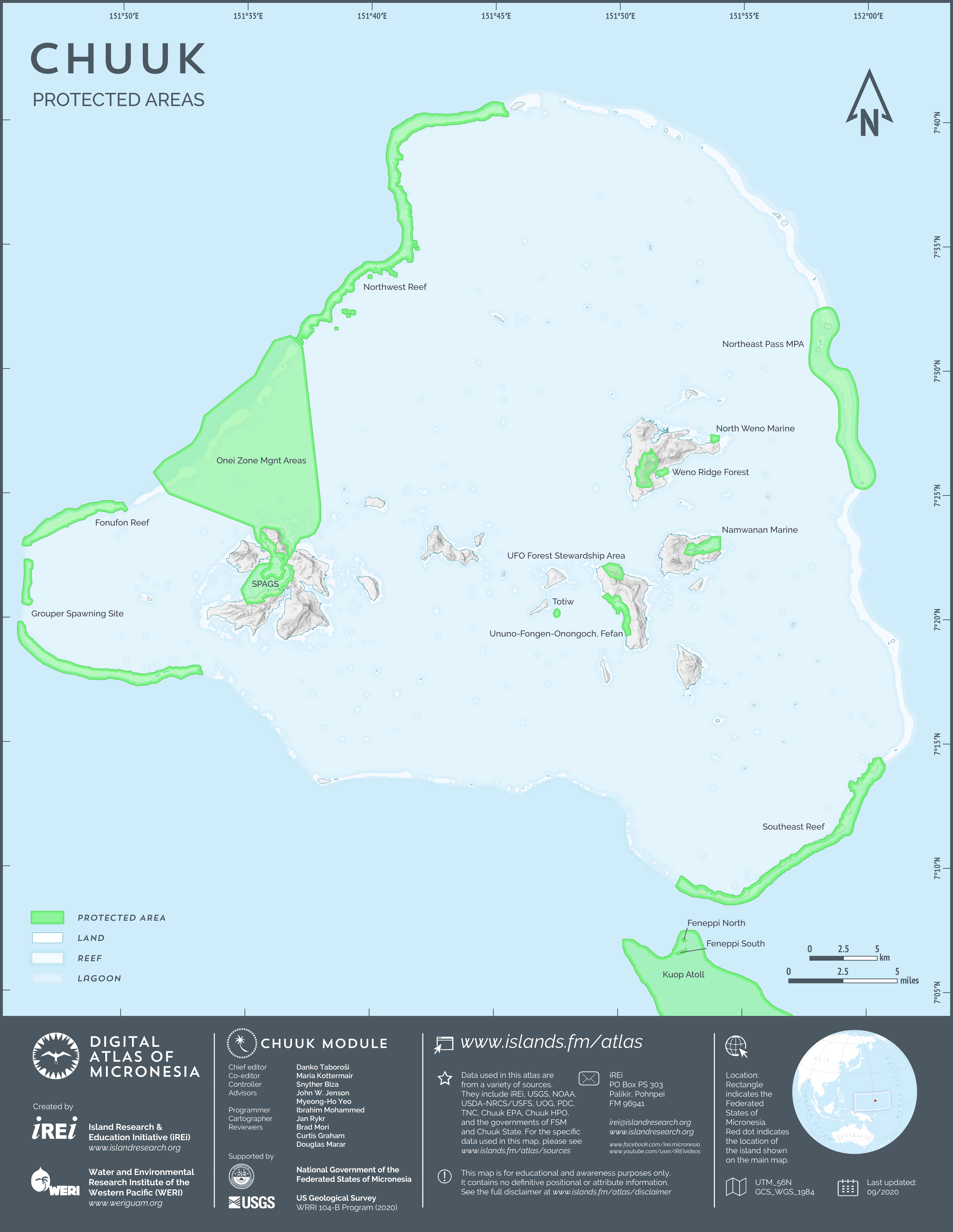
Designated protected areas

This map shows the designated protected areas in Chuuk Lagoon. The dataset was created by Island Research & Education Initiative (iREi) (2020) by merging a variety of relevant information obtained from Chuuk State Government, The Nature Conservancy, and Chuuk Environmental Protection Agency (Chuuk EPA).

Conservation targets

Areas of biodiversity significance

Areas of biodiversity significance

his map shows the Areas of Biological Significance (ABS) in Chuuk Lagoon. The dataset was created by The Nature Conservancy. A subset to show only Chuuk was created by the Island Research & Education Initiative (iREi) (2020). The polygons in the data are intended to capture those areas that represent the wide range of biodiversity features in the marine and terrestrial areas of FSM. They capture expert knowledge from the FSM Blueprint project. They are used to guide conservation planning and projects in FSM, and ultimately to help establish conservation areas.